|
Our World of Water
Histories of the Hydrosphere November 4, 2017
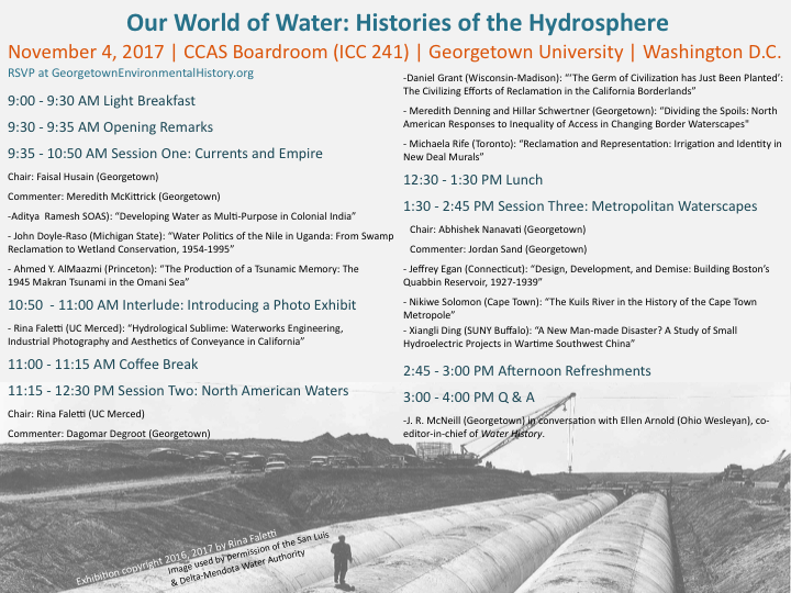
Georgetown University, Washington, DC SCHEDULE
ABSTRACTSAditya Ramesh (SOAS)
Developing Water as Multi-Purpose in Colonial India In 1934, the first multi-purpose reservoir to be built in colonial India, at what was a remote village known as Mettur in southern India, was inaugurated with much pomp and splendour. The Mettur Project as it was known, built on the river Cauvery, had a long and chequered history. Contemplated as early as the mid-nineteenth by military engineers of the Madras Province, the project did not fully come to fruition until the early decades of the twentieth century. This paper poses the question as to how the modern multi-purpose river valley project, one on which independent India staked its developmental future, became a possibility during colonial times. Reaching back into the second half of the nineteenth century, it will argue that interest from London financial markets in rendering Indian rivers productive, a famine in the 1870s, and the state being pushed to the forefront of building public works were all central to the first reservoirs being built in the 1880s. In the decades after the First World War, the colonial state sought to ‘develop’ the river in new ways, especially in relation to producing hydroelectricity. In the Madras Presidency, a province lacking coal, hydroelectricity was viewed as a way to expand and diversify the economy. It was however technological innovation on the construction site of the Mettur Project by colonial engineers, which finally allowed for conversion of water into hydroelectric power. Sensing the potential for economic profit, colonial engineers and revenue officials made plans to invite industries to create an industrial-urban town around the Mettur dam, alongside an organized fishery. However, the transformation of water into a multiple purpose resource was not a smooth one, as water for irrigation purposes came into conflict with water use for hydroelectricity. This paper tracks the uneasy arrival of the multi- purpose project in India, unravelling the global flows of finance and technology during the nineteenth century and inter-war era which facilitated it, and the local conflicts it created. John Doyle-Raso (Michigan State) The Water Politics of the Nile in Uganda: From Swamp Reclamation to Wetland Conservation, 1954-1995 Early British colonizers in Uganda associated swamps with disease, monsters, and unproductivity. They transformed extensive swampland into cities and farmland, calling it reclamation. After 1954, with the completion of the Owen Falls Dam across the Victoria Nile – the only outlet of Lake Victoria and one of two sources of the Nile – they found new resolve. Colonial development experts learned by engaging in Nile water politics that reclamation increases the amount of water in the lake basin, and argued successfully to their counterparts downstream that this water belongs to those reclaiming it. The late colonial and early independent governments of Uganda pursued reclamation because it provided a resource otherwise denied to East Africa under the 1929 Nile Waters Agreement: water for irrigation. Yet, in the late twentieth century, environmental policies worldwide shifted from swamp reclamation to wetland conservation. By renaming swampland as wetland – an innocuous new word – its preservation could be desirable (today, ecologists refer to a typology of wetlands, including bogs, fens, and swamps). Proponents cited ecosystem services, e.g. nutrient filtering and wildlife habitat, as reasons for preservation. They produced a new form of knowledge and recreated environmental institutions with the twinned aims of national and basin-wide resiliency, with the result that, in 1986, the Ugandan government banned reclamation in favour of wetland preservation. In 1995, Uganda became the first country in Africa with a national policy on wetlands. This paper narrates tensions between reclamation and conservation projects through the changing landscape of the Nile in Uganda, focusing in particular on the production of sugar and rice in eastern Uganda. Ahmed Y. AlMaazmi (Princeton) The Production of a Tsunamic Memory: The 1945 Makran Tsunami in the Omani Sea The littoral communities living across the Omani Sea and the British colonialists on November 28, 1945, witnessed the raging seascape and its towering waves—which reached a run-up height of 40 feet—that took with them thousands of lives in the aftermath of an earthquake measuring magnitude 8.1 in the Makran subduction zone. Expanding the UNESCO’s Oceanographic Commission project to document the accounts of the Makran 1945 tsunami eyewitnesses, I aim to contribute to tsunamic historiography and anthropology. I do so by situating the understanding of the phenomenon as socio-politically constituent of natural disasters’ collective memory. Despite being a historical event that was reported accordingly by the colonial security apparatuses, it is contextualized differently by the affected colonized populations. I ask, thus, on the one hand, how is it produced historically as a natural menace against the colonial coastal projects? And on the other, how have coastal communities perceived, interpreted, and remembered such a traumatic natural disaster? And in what ways has that reflected and shaped their geographic imaginations of nature as an agentive historical factor? This paper examines the native community memory in narrating lived encounters with a tsunami and compares it to that reported by the British colonialists using ‘narrative network analysis.’ Specifically, the analysis engages with the recorded native historical narratives in retelling the event as well as the colonial archival sources that have depicted it. Treated as distinctive sociohistorical productions of an environmental event that illustrate the varying social relations with the Omani Sea as a transcultural area, this paper demonstrates the making of the ‘tsunamic memory.’ It is analyzed as transcending its referential seismological nature in a shared space to be socio-historically embedded in and emblematic of indigenous geographic imagination, collective memory, and colonial relations with the colonized seascape and its environmental and social natures. Daniel Grant (University of Wisconsin-Madison) “The Germ of Civilization has Just Been Planted”: The Civilizing Efforts of Reclamation in the California Borderlands, 1910-1920 As the 20th century opened on the newly irrigated California borderlands, the U.S. Reclamation Service set its sights on cultivating agriculture at the Fort Yuma Indian School located on a bluff above the Colorado River. The school and its 160-acre farm, overseen by the agents of the Bureau of Indian Affairs (BIA), operated by paid Indian workers, and attended by Indian children, would serve as a model for irrigation districts nationwide. But reclamation was as much a project of social engineering as it was one of infrastructure development. It is no accident that assimilation—the cultivation and regulation of “civilized” behavior on the reservation, including baptisms, western medical care, and strict drinking laws—both enabled and were enabled by irrigation. By 1920 8,000 acres of productive land on the reservation, watered by irrigation ditches, had been allotted to individual Indian families, who were expected to claim and work it as their own as Jeffersonian yeoman farmers. But such expectations could not be fully realized because the agencies placed them in an impossibly contradictory position: to assimilate into western society productively only insofar as their irrigated land demonstrated to the federal government the “civilizing” effects of irrigation, but nothing more. From reports written by BIA field agents between 1910 and 1920, I argue in this paper that the daily politics of the reservation was a crucial forum for understanding the social intents and effects of reclamation. Meredith Denning and Hillar Schwertner (Georgetown University) Dividing the Spoils: North American Responses to Inequality of Access in Changing Border Waterscapes In North America during the first decades of the twentieth century, the waterscapes of the border zones between Mexico and the United States, and between Canada and the United States, changed dramatically. Major infrastructure projects in boundary watersheds were executed with both public and private funds. By the 1920s, groups within all three countries were debating whether or not the benefits of these investments were equitably divided, and each initiated policies aimed at redressing the balance. In the Colorado River watershed, California successfully lobbied the American federal government to build the Hoover Dam and to supply water to its Imperial Valley farmers through an All-American Canal running parallel to the Mexican border. These projects reduced flooding on the Colorado River below the Hoover dam, incidentally creating new areas of arable land in Mexico, with tremendously productive soils. Responding to this new waterscape, and also to decades of indifference from American investors and hypocritical, unilateral adjustments to the border hydrology from American policymakers, President Cárdenas decided to expropriate American-held properties and to “colonize” the former floodplains of Baja California with Mexican farmers. This initiative was, in part, a response to the changing hydrology—it was an effort to address the inequality of access to the “improved” international waterscape. In the Great Lakes watershed, Canadians and Americans worked together to adapt Niagara Falls and the St. Lawrence River for hydroelectricity, changing hydrography through private investment with public support. In Ontario, opponents of hydroelectric exports argued that by sending power to the United States, private utility companies hindered domestic industrial development and rural electrification. They successfully lobbied the Ontario provincial government to take ownership of electricity generation, transmission and distribution infrastructure in 1928. In New York State during the same period, Governor Roosevelt argued for public ownership of utilities for many of the same reasons. His administration created the Power Authority of the State of New York, which took over the task of providing electricity from private companies. Michaela Rife (University of Toronto) Reclamation and Representation: Irrigation and Identity in New Deal Murals In 1910 a group of homesteads in northwest Wyoming, which had grown up around a federal irrigation project, became a town bearing the surname of the “father of reclamation,” John Wesley Powell. Thirty years later another government project reminded residents of their debt to irrigation technology, in the form of Verona Burkhard’s New Deal post office mural, simply titled: “Powell’s Agriculture Resulting from the Shoshone Irrigation Project.” This paper will draw from my dissertation research on land use depictions in New Deal murals to argue that water from irrigation, whether visible in depictions of a canal, or “invisible” in a painting of a fertile field, was a key visual symbol in promoting agricultural identity in the American West. Burkhard’s mural, for example, depicts a quaint white farming family standing before a collection of healthy livestock and rows of crops irrigated by canals cut into the naturally arid earth. References to the town’s irrigation identity can still be found throughout Powell’s visual and material culture. These visual sources point to the ways that water, in the form of irrigation, was instrumentalized by settlers to lay claim to arid Native land, both physically and conceptually. New Deal murals also occupy an interesting hinge moment, between the historical memory of Euro-American settlement and the boom of thirsty industrial agriculture, all during a period characterized by drought and crop failure. Furthermore, as optimistic images during the Great Depression, these murals can tell environmental histories both through what they depicted, as well as what they chose to omit. I argue that when these sources are viewed as more than simply illustrative they can provide a window on the history of water and land use in the arid West, while also offering historical perspective on persistent agricultural identity. Jeffrey Egan (University of Connecticut) Design, Development, and Demise: Building Boston’s Quabbin Reservoir, 1927-1939 Sixty-six miles west of Boston lies the largest lake in southern New England. On sunny days, its crystal-clear waters reflect a shoreline of coniferous trees—red and white pine, spruce, larch, and hemlock, mostly. In summer, visitors flock to its shores to hike and fish, sometimes chancing a glimpse of one of the bald eagles that have taken refuge there in recent years. Yet, this is no nature reserve or national park; it is Quabbin Reservoir—an artificial lake built from 1927 to 1939 to supply water to Greater Boston. When the Massachusetts legislature approved this project, it gave the Boston Metropolitan District Water Supply Commission unprecedented power to purchase, manage, and transform a watershed spanning 185.9 square miles—nearly 2% of the entire state. My paper tells the story of an engineering marvel under construction and a rural landscape—the Swift River Valley—torn apart. Engineers and laborers bored a twenty-five-mile aqueduct tunnel under the Massachusetts countryside—the world’s second longest at the time—and built two large earthen dams to hold back the 412-billion-gallon reservoir. They reforested the surrounding hills with ten million new trees and chopped and burned their way across the thirty-nine-square mile basin. But, in the process, they also displaced 2,500 rural residents, removed 7,500 graves, and erased four towns from the map. This paper—a chapter from my dissertation Watershed Decisions—examines this event as an expression of what historians such as Adam Rome, Bruce Schulman, Paul Sutter, and others have come to describe as the rise of the “environmental management state.” Here I explore the building of Quabbin Reservoir and the attendant human costs: the pain of eviction, loss of home, and deeply-strained relationship between urban Boston and rural western Massachusetts during the first half of the twentieth century. Nikiwe Solomon (University of Cape Town) Fluid Relations: The Kuils River in the History of the Cape Town Metropole Using the Kuils River as a case study, this paper reflects on the human-river relationship in the history of the Cape Town metropole. Drawn from ethnographic research, the paper explores the ways of relating between the various actors and how they have enacted the Kuils River in relation to the city’s history. The paper demonstrates that in South Africa, the history of the discourse around water management is often highly anthropocentric, technical and assumes that there is a singular viewpoint from which to develop and implement solutions. However, even hydrological approaches to water are not free of socio-cultural values and the Kuils River case study demonstrates this. The threat of the poor water quality, poor service delivery and tensions arising from inherited colonial spatial planning and development agendas have generated conflicts between nature, science, techno-efficiency, legal instruments and politics. Through looking specifically at the river course, in recent history and now -- through aerial photos, early maps as well as oral narratives, the paper traces the river’s entanglements with the city. The paper looks at the history of the ecologies of practice along the Kuils, the role of power, becoming, belonging, subsistence and livelihoods on the urban periphery. From the research, a theme that came out quite strongly was that of the “undesirables” and waste streams. The paper therefore look at the history of the “undesirables” and waste. It explores the efforts to manage and control the expansion of these “undesirables” beyond allocated spaces of the Cape Town metropole. Xiangli Ding (SUNY Buffalo) A New Man-made Disaster? A Study of Small Hydroelectric Projects in Wartime Southwest China It is well known that the Chinese Nationalist broke the dike of the Yellow River to delay the march of Japanese army in a destructive way. Meanwhile, the Nationalist also built hydropower projects in the southwest, trying to use water in a more constructive way. Before and during the War of Resistance against Japan (1937-1945), the energy crisis stimulated the Nationalist government’s surveying, planning and building of hydropower projects in southwest China. Through examination of the Longxi River project and Fuyuan Electrical Company in the area of the wartime Nationalist capital of Chongqing, this paper analyzes the interactions among warfare, energy, rivers and local community in the southwest. When there was insufficient water in the rivers or the reservoirs to drive the turbines, factories and other electricity consumers had to adjust their daily behavior based on the ultimate natural and not completely controllable rise and fall of rivers. In addition, this paper underlines the social effects of those projects. The hydropower plants undermined riverside community’s right of using water by submerging watermills and farmlands. In a short term, only those upscale households and businesses in town benefited from the hydropower project, not farmers along the river, or anyone residing around the plant and the dam. Thus, they emotionally attributed an unexpected flood to the building of dam on the river, blaming it as the source of a new man-made disaster. In sum, through rebuilding waterscape in the southwest, those hydropower projects not only provided energy for the War of Resistance against Japan, but also stimulated tensions among local society. |